GROUP 6

Coastal Erosion

Coastal erosion is the process through which rocks, sediments, and sands near the coastline may be eroded or transported away. Local sea level rise, substantial wave action, and coastal floods all contribute to coastal erosion. Storms and other natural occurrences may cause erosion along any coastline; however, the most destructive circumstances are produced when a storm surge at high tide is paired with the impacts of heavy waves. These circumstances are often linked with tropical storms that reach landfall. As a consequence of the rise in global sea level, the breadth and severity of the problem are worsening, but since the situation varies throughout the country, there is no solution that is applicable everywhere.

Causes of coastal erosion

  • Danger of waves
  • Currents, tides
  • Wind-driven water
  • Waterborne ace
  • Other storms impact
  • Human activities
  • Constant changes in the natural environment

What to do to prevent coastal erosion

  • Beach nourishment
  • Habitat restoration
  • Living shorelines
  • Shoreline hardening

What to do during coastal erosion

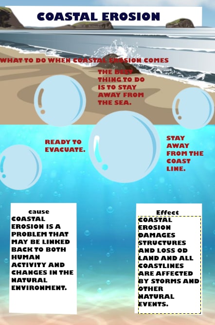
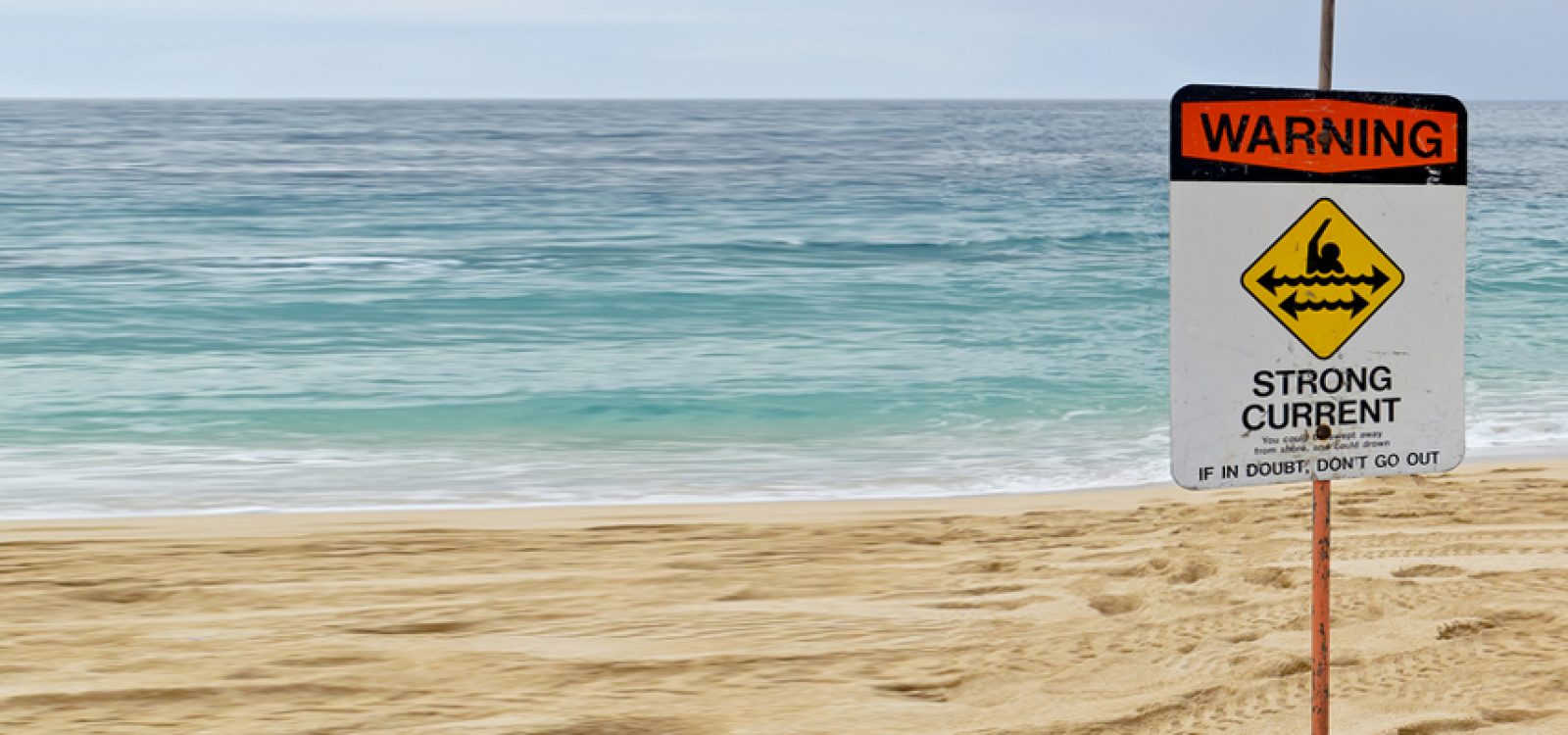
1. The best thing to do is to stay away from the edge of the sea for a while

demo-img

2. Prepare yourself for the fall of the land due to the impact of the waves or water

demo-img

3. Call the NDRRMC or National Disaster Risk Reduction and Management Council

demo-img

4. Stay away from the coastline

demo-img

5. Ready to evacuate

demo-img

After coastal erosion

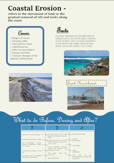
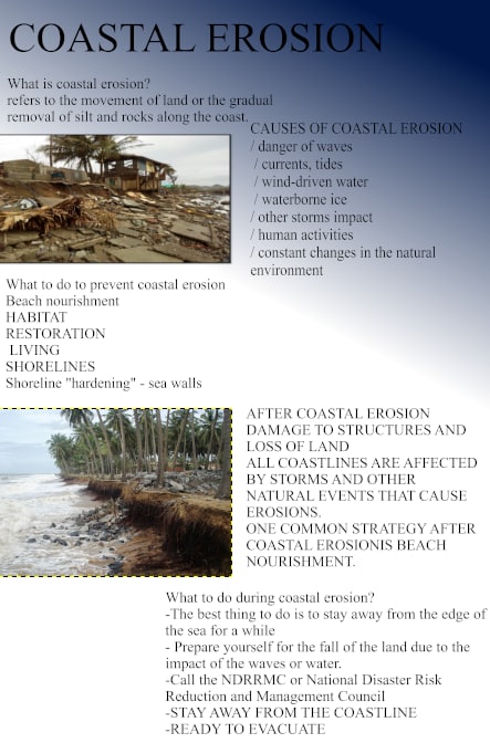
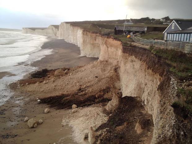
Beach nourishment, also known as the placement of more sand on a beach in order to function as a buffer against erosion or to boost the beach's recreational value, is a common strategy for preventing coastal erosion. Beaches may be nourished by placing additional sand on them.

FACTS

      Coastal Erosion is a rather slow process that may take hundreds of years, but researchers believe that climate change is speeding up the process significantly. As a direct consequence of climate change, the sea level has increased, as have the frequency and severity of storms, both of which are substantial contributors to erosion. In reality, the Environment Agency of the United Kingdom has estimated that the coastline of the United Kingdom might erode between 67 and 175 meters (or 220 and 580 feet) during the next century.
costaline
      The ocean is now destroying the coastlines of a great number of Philippine places, most of which are coastal. Human activities, such as the destruction of coral reefs, are also to blame for the problem, in addition to natural forces such as wind and waves. It is projected that the breadth of this problem, as well as the impact it has, would extend as a result of climate change and the rise in sea level. It is also projected that ongoing urbanization and the construction of additional coastal villages will contribute to the problem's worsening.
      Towns in the Philippines most affected for coastal erosion: Baybay City, Palo, Tolosa, Tanauan, Dulag, Mayorga, McArthur, and Abuyog are very sensitive to coastal erosion, some of the coastal barangays in Villaba, Leyte, Tabango, San Isidro, and Calubian

Philippine Hazard Map for Coastal Erosion

hazardmap

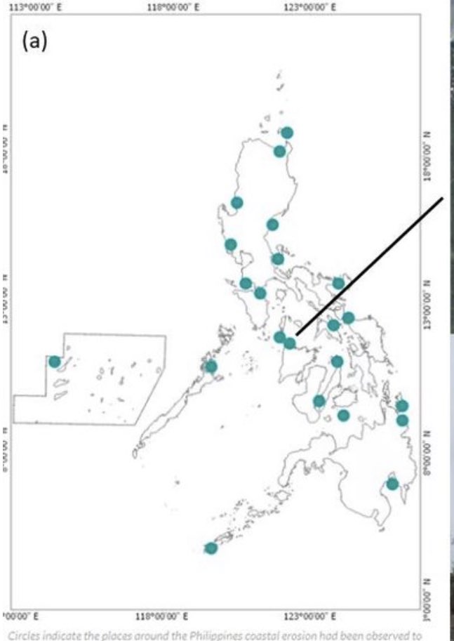
      According to the Research of Bautista et al. (2020), The Philippines, an archipelagic nation with a coastline of at least 36,000 kilometers, has been classified as including more than twenty locations at danger of coastal erosion. One of these places, which is situated in Ibajay, Aklan, was subject to an examination. A three-dimensional numerical model was developed in order to simulate and assess the existing hydrodynamics as well as the silt flow. Using continuous data on water level and velocity collected from sensors deployed in two independent field surveys, the correctness of the model was ensured. The findings of the model are highly congruent with the actual data and properly represent the tide-dominated hydrodynamics of the investigated region. By simulating flows under flood-ebb, spring-nap, southwest-northeast monsoon, and 2-year circumstances, the temporal variability of the hydrodynamics and transport of sediments was examined. Using the findings of the long-term simulation, the locations of places that suffered erosion and deposition were determined. Except for the region along the stream where local erosion and deposition processes occur, none of these zones were situated along the coastline. On the basis of this information, it is possible to conclude that the coastline in issue is safe given the current tide conditions. The collected findings may be utilized as baseline data for guiding the municipality's future coastal development, and the approach employed in this study can be extended to other erosion-prone beaches in the United States.

Importance of a Hazard Map

      Assessments of hazards and risks are the essential first step in disaster risk management (DRM) and the foundation for developing DRM policy. They must consider worst-case scenarios in the event of the greatest conceivable danger, while acknowledging that hazard evaluations of earthquakes and tsunamis will always have limits and related uncertainties. The purpose of hazard maps should be to advise and promote rapid evacuation. They should be easily accessible and simple to comprehend. Primarily, they are constructed to resist any calamities. Hazard maps are tools that, when utilized correctly by planners, developers, and engineers, may save lives and save economic losses by preventing exposure to certain dangers and designing other projects to mitigate or eliminate the possible adverse effects of these hazards.

NOAH

      UP NOAH is a public disaster risk reduction program designed specifically to reduce dangers in the nation. You can enter your current location or any other location in the Philippines on this website to learn about the dangers and nearby establishment that could assist in disaster relief.

feu-hazardmap

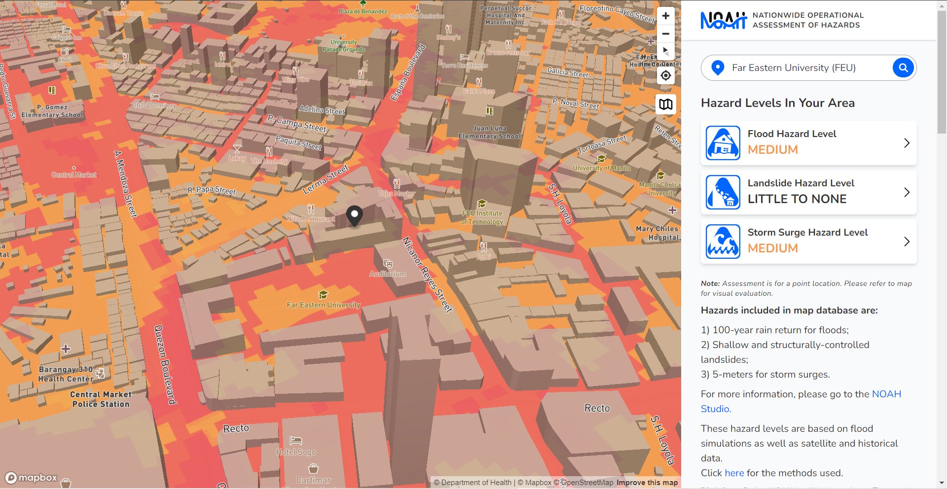
Far Eastern University's Hazard Map

PETA No. 1

peta-img peta-img peta-img

References

Bautista, D., Herrera, E., Hernandez, B., & Yoshikai, M. (2020, May). Numerical investigation of coastal sediment transport for assessment of coastal erosion of a Philippine coastline using a 3D hydrodynamic model. ResearchGate. https://www.researchgate.net/publication/341765478_Numerical_investigation_of_coastal_sediment_transport_for_assessment_of_coastal_erosion_of_a_Philippine_coastline_using_a_3D_hydrodynamic_model
Coastal Erosion Facts. (n.d.). Some Interesting Facts. from https://someinterestingfacts.net/coastal-erosion-facts/
Department of Homeland Security. (n.d.). Protect your Property from Coastal Erosion. FEMA.gov. from https://www.fema.gov/sites/default/files/2020-11/fema_protect-your-property_coastal-erosion.pdf
Hazard Maps. (n.d.). Pacific Northwest Seismic Network. from https://pnsn.org/outreach/hazard-maps-and-scenarios/hazard-maps
Hillebrand, S. (2021, April 1). Coastal Erosion | U.S. Climate Resilience Toolkit. U.S. Climate Resilience Toolkit. from https://toolkit.climate.gov/topics/coastal-flood-risk/coastal-erosion
Sagara, J. (n.d.). KNOWLEDGE NOTE 5-1 Risk Assessment and Hazard Mapping. PreventionWeb. from https://www.preventionweb.net/files/29163_drmkn511.pdf